As we go about our daily lives, most of us give little thought to how our neighbourhoods, suburbs and cities have been planned before they are constructed. Why there’s a playground on that particular corner, or a shopping centre at the end of that street.
The fact that we don’t often think about it is testament to good urban planning – understanding the community and its needs; setting out where there should be residential growth; what amenities (such as retail, education and health and community services) are needed in the surrounding areas; and how to preserve and protect our landscape.
However, in recent years there have been concerns and questions raised – with the Committee and in other forums – about issues such as mobility, accessibility and connectivity, including infrastructure and costs.
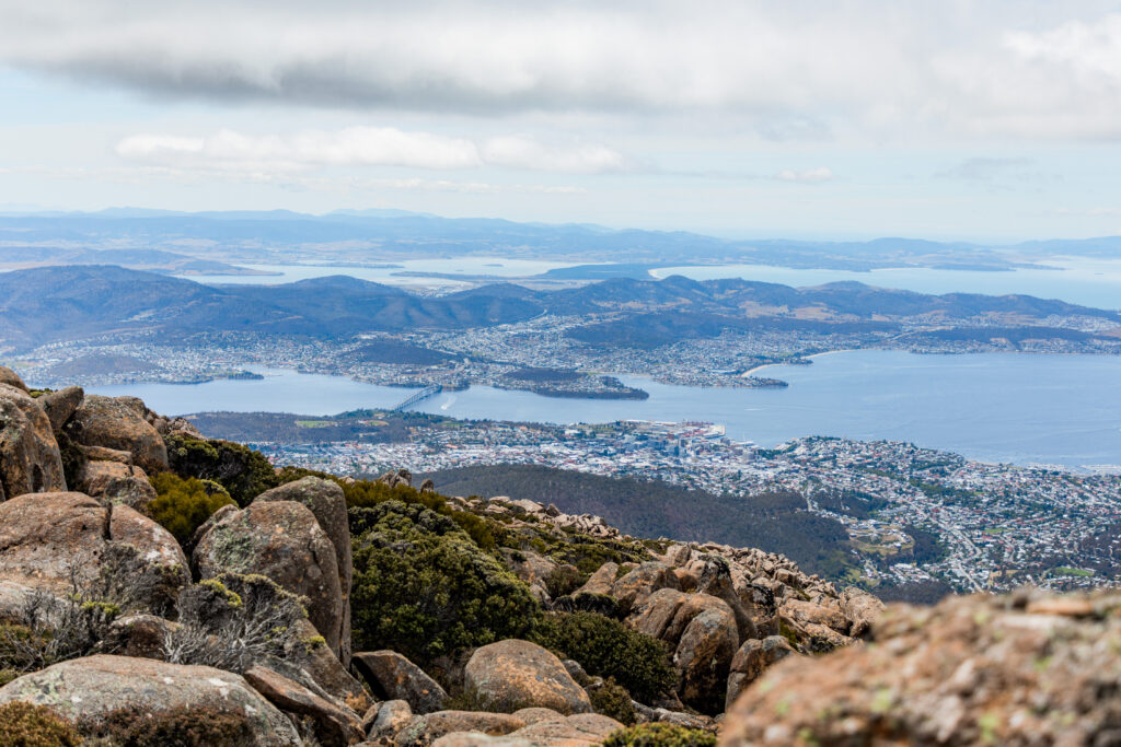
Tasmania’s Regional Land Use Strategies plan up to 25 years ahead, setting the direction for how land use change, growth and development in our regions will be managed. They are designed to implement the state’s planning policies in ways that are appropriate to each region, and guide local strategic planning and the preparation of planning schemes in the local government areas.
The Southern Tasmanian Regional Land Use Strategy (STRLUS) was first declared in 2011, with minimal updates and changes in the past 13 years. In that time there have been significant changes in our population, demographics, land use and economy that are important to explore in how we’ve gotten to this point.
The STRLUS released in 2011 forecast that by 2035, Southern Tasmania would have an indicative planning population of 327,036 and 138,700 dwellings.
However, in 2023^ the Southern Tasmanian population was already at 298,589 and the number of dwellings 138,532, with an estimated 27,665 more dwellings needed in the next 23 years.
The STRLUS State of Play report, released on 23 September 2024, shows that in the past 10 years:
The impacts on our communities of increased development in previously untouched urban areas, and a lower number of denser, multi-faceted developments utilising land that is already connected to services and amenities, include:
Renewables, Climate and Future Industries Tasmania (RECFIT) research projects that in the next 75 years there will be an increase in extreme weather events such as frequency and intensity of storms, coastal erosion and inundation, longer fire seasons and more days of high-range fire danger, an increase in summer temperatures and more heatwaves, an increase in drought conditions in some parts of the state, and river flooding in some catchments.
We have already seen an increase in extreme climate and weather activity in the past 10 years, including significant bushfire seasons, unprecedented marine heatwaves and prolonged droughts.
The State Government’s TasAlert website enables you to map the natural hazard information for where you live, including bushfire, coastal erosion and inundation, and landslide. A quick search shows a large amount of Greater Hobart’s bushland areas listed as bushfire-prone or at risk of the impact of bushfire (smoke and embers) – an alarming amount of which is increasingly seeing residential development.
People living in more urbanised areas are also seeing the impacts of increased temperatures. Menzies Institute for Medical Research^^ shows a 9 per cent increase in deaths in Tasmania during low-intensity heat waves.
University of Tasmania research** shows that LGAs such as Glenorchy are at high risk of heat-related deaths due to low levels of tree cover, higher use of brick and concrete in construction, and higher levels of social vulnerability due to socio-economic factors and population age. The research also shows the presence of trees in neighbourhoods can reduce air temperatures by as much as 10 degrees and over roads by up to 20 degrees.
By knowing how our communities are planned, what makes them great places to live, work, study and enjoy, and the opportunities that exist to make changes for a better future, we can all contribute to this balance.
As the Committee for Greater Hobart, we will be hosting a forum of members, business leaders, stakeholders and the community to discuss key challenges for the region and opportunities and aspirations for the future. We will use this to provide feedback into the STRLUS process. All Southern Tasmanian residents can engage with the process and have input via https://www.shapingtasmania.com.au/
^Source data: Remplan/ABC Census of Population and Housing 2021
*Sources: ABS, Department of Health The State of Public Health Tasmania 2018.
^^Source: Assessing mortality associated with heatwaves in the cool climate region of Tasmania, Australia, authored by Sharon L. Campbell, Nicolas Borchers-Arriagada, Grant J. Williamson, Fay H. Johnston.
**Source: A rapid assessment method and policy framework for improving heatwave resilience in Tasmania’s major cities, authored by Jason Byrne, Agustina Barros, Sebastian Rossi, Roxane Bandini-Maeder, Alex Bandini-Maeder, Bradley Johnson, H-Y Phan, Gabrielle Priest, Bethany Cox.